Monday, October 04, 2010
Scenic Byways I, II

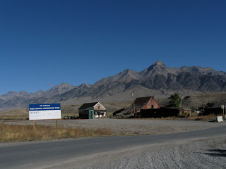
Idaho has many designated "scenic byways" and on our trip home we traveled many of them--avoiding civilization and internet hookups in favor of canyons and mountain passes. We started out on the "Peaks to Craters" scenic byway. (which goes past the highest peak in Idaho) As there was no dump station in Craters, our first stop was in the tiny town of Mackay where there is a city rest area with dump station. I snapped this photo of the "Technology Park" across the way. We were on our way to Challis, Idaho, a mining town where our friends Ken and Louise once lived. At Challis, we stopped at a lovely state park interpretive center--and continued onto the "Salmon River" scenic byway. If I could control where photos went in this blog--I'd throw in a photo of the Salmon River here but I know if I do it will pop to the top and ruin the sequence. Suffice it to say, it is a lovely scenic river which winds around the state. We were told by the staff at the state park to take a detour off the main highway to visit some ghost towns, which were only 8 miles off the highway up Yankee Creek on a part paved, part gravel road. It turned out to be worth the side trip to see the remnants of the town of Bonanza, and a dredge which they used to get gold from the creek in the 50's. (Which explains the piles of rocks you see along the creek in this area). Then a bit farther on there was the ghost town of Custer--a little more civilized with a museum which was closed but lots of interpretive signs and artifacts. (Photos are in a separate entry) On our way back to the highway we stopped to check out a National Forest campground right on the creek--no one else around. There were fee envelopes but no prices anywhere so we decided it was free this late in the season. No one else there--little traffic --an idyllic spot.